The Lost Village


As I mentioned here, the village of The Lodge (so named as it was at the entrance to the driveway of the seventeenth century Brymbo Hall which stood a few hundred yards to the west) was once much larger than it is today.
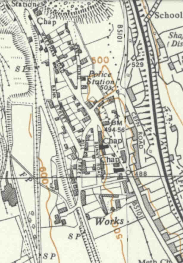
Here's a map showing the village in the 1950s:

You can see from this that there were some sixty or seventy houses and other buildings to the west of the B5101, including three chapels, a post office and a police station.
The village had long lived in the shadow of Brymbo Steelworks to the north-west of it, and it was I suppose inevitable that when the works needed to expand in the 60s and early 70s that the shadow became an mortal threat.
And so it proved, with almost everything on the western side of the main road demolished in the years between about 1963 and 1978 and buried under thousands of tons of earth, slag and whatever else came to hand.
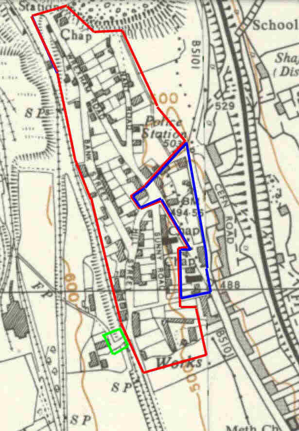
You can see from the map below what was demolished in the first phase (bordered in red):

That's one hell of a lot of people's homes, businesses and lives to get rid of, isn't it? And, given that there were not enough houses on the eastern side to accomodate the refugees, the population of The Lodge was slashed to a small percentage of its previous level in a few short years.
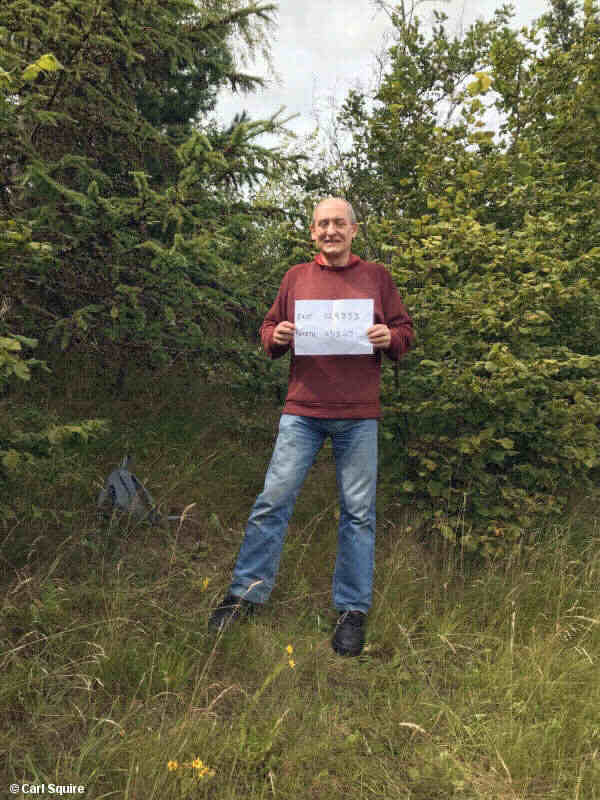
My old friend and former long-term colleague Carl Squire and his family were amongst the displaced. Here he is in August 2020 standing at the co-ordinates of his birthplace (14, Wrexham Road):


Grid reference: SJ300529
Co-ordinates: 329858, 353251
Bearing: not known
In his own words, "I just needed a spade and a lot of pit props.".
I can't remember the full extent of the old village, but I am just about old enough to remember what was left after the initial dismemberment. This is outlined in blue on the map above. All that was left were the houses along the western side of Kent Road (the B5101) and the lower part of Wrexham Road (including - perhaps somewhat incongruously - a shoe shop to which my mother would drag me at regular intervals during my childhood). A handful of houses, one chapel and the post office were all that remained.
Then during the second half of the 1970s, all that went as well, leaving little more than a ten-foot-high ridge along Kent Road. Only one building was left on the western side of the main road (just below the bottom of the blue box on the map). And that's all there is to this very day.
The bitter irony is that, although the steelworks did expand southwards during that time, very little practical use of the land cleared was made.
And then, of course, the steelworks was closed by a bunch of asset-strippers in 1990, so the destruction of a community had been all for nought. The steelworks closed and - eventually - the site was reclaimed.
Something interesting has emerged from that process. Look again at the map. You'll see a small area in the south-western corner outlined in green. This marks the point where the top of Hill Street crossed the old Wrexham, Mold & Connah's Quay railway line (later the Great Central Railway) between Brymbo and Wrexham (once again, see the entry for this line at Disused Stations for a fuller picture). During the reclamation process, a small length of the line was uncovered along with the remains of the bridge. I'd come across it before a few years ago when walking the footpath from the bottom of Tanyfron back up the old line north of Ochnall's Bridge, and in early August 2020, I went looking for it again from the other side.
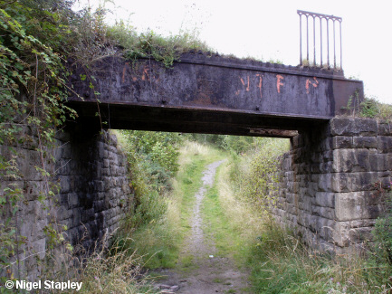
It was a bit further from home than I'd bargained for (it stands above the one remaining building on the western side of The Lodge), but I found it before too long:

The bridge is quite battered, as you can imagine after being buried under a huge weight of rubble and what-'ave-yew for nearly fifty years; most of the railings are missing and there's a hole in the rear right of the bridge which can be seen here.
You might wonder how on earth trains could have got under there, but it's quite clear that in doing the landscaping they only bothered digging down to the level where the trackbed could be used to walk or cycle under it. Nonetheless, a part of our local history has now come back into the daylight and creates a new connection to our past while there are still people to recall those times.
© Nigel Stapley & Carl Squire


